Map - Little Cayman

Little Cayman
 
Map - Little Cayman
Map
Google Earth - Map - Little Cayman
Google Earth
Openstreetmap - Map - Little Cayman
Openstreetmap
Map - Little Cayman - Esri.WorldImagery
Esri.WorldImagery
Map - Little Cayman - Esri.WorldStreetMap
Esri.WorldStreetMap
Map - Little Cayman - OpenStreetMap.Mapnik
OpenStreetMap.Mapnik
Map - Little Cayman - OpenStreetMap.HOT
OpenStreetMap.HOT
Map - Little Cayman - OpenTopoMap
OpenTopoMap
Map - Little Cayman - CartoDB.Positron
CartoDB.Positron
Map - Little Cayman - CartoDB.Voyager
CartoDB.Voyager
Map - Little Cayman - OpenMapSurfer.Roads
OpenMapSurfer.Roads
Map - Little Cayman - Esri.WorldTopoMap
Esri.WorldTopoMap
Map - Little Cayman - Stamen.TonerLite
Stamen.TonerLite
Country - Cayman_Islands
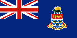
The Cayman Islands is a self-governing British Overseas Territory, and the largest by population. The 264 km2 territory comprises the three islands of Grand Cayman, Cayman Brac and Little Cayman, which are located to the south of Cuba and northeast of Honduras, between Jamaica and Mexico's Yucatán Peninsula. The capital city is George Town on Grand Cayman, which is the most populous of the three islands.

The Cayman Islands is considered to be part of the geographic Western Caribbean Zone as well as the Greater Antilles. The territory is a major world offshore financial centre for international businesses and wealthy individuals, largely as a result of the state not charging taxes on any income earned or stored.
Currency / Language  
ISO Currency Symbol Significant figures
KYD Cayman Islands dollar $ 2
ISO Language
EN English language
Neighbourhood - Country  
Language